The path from Mousehole to Falmouth takes you along the southernmost point of the UK, past the halfway point of the South West Coast Path and into one of the largest natural harbours in the world at Falmouth.
The South West Coast Path day-by-day guide actually starts this section in Lamorna. However, because I was doing this hike in August, Cornwall was very busy and I was limited on accommodation options. I stayed in a lovely pub with rooms in Mousehole for a few days before embarking on the six-day hike from Mousehole to Falmouth.
It’s not my intention to repeat the extremely helpful information you can find on the South West Coast Path website. This is an account of my own experience with tips I would have found useful to know before embarking on the hike from Mousehole to Falmouth.
Getting to Mousehole
If you’re travelling from London to Mousehole, you can do so in two easy stages.
First, catch the train from London Paddington to Penzance. Penzance is at the end of the line and the journey takes around five hours.
Then to get from Penzance to Mousehole, you can catch a bus along the three miles of winding sea road.
Mousehole
I recommend spending a day in Mousehole before you start the hike. Mousehole is a small town with an enclosed harbour, steep cobbled streets and a seafaring history. The fact that the Spanish tried to invade England at Mousehole in the sixteenth century is always conveniently omitted from English history books.

Day 1: Mousehole to Marazion (6 miles)
Start your hike from Mousehole to Falmouth by walking the three miles along the road to Penzance. Penzance is one of the larger towns in Cornwall and has a wide promenade along the sea.
After Penzance, follow the path alongside the railway line around the curve of the coast all the way to Marazion. Marazion is most famous for St Michael’s Mount, a castle atop a hill on an island in the bay accessible only at low tide across a paved walkway which disappears beneath the sea when the tide is in. You can book tickets to St Michael’s Mount on its official site.

The South West Coast Path from Mousehole to Marazion is not particularly rural or scenic, taking you through Penzance and some smaller villages. But this does mean that you’re in for a fairly easy day of walking on your first day as the path goes mainly along paved roads.
Day 2: Marazion to Porthleven (11 miles)
Out of Marazion, you’re in for a treat. The path winds through secluded rocky coves, the highlights for me being Prussia Cove and Praa Sands. This area is where my grandma lived during the Second World War so I feel a particular connection to it.
The path rises and falls throughout the rest of the day. But your reward is Porthleven, a typical Cornish fishing village complete with a walled harbour. If you ever watch footage of winter storms in Cornwall, you might recognise Porthleven’s clock tower which usually provides the backdrop for fierce waves crashing ashore.
Because I did this section of the South West Coast Path in August (peak summer holiday season), I was rather stuck for places to stay along the route. I therefore had to continue for another seven miles to Mullion where I stayed in a lovely thatched inn. I was glad the first day of the hike had been a relatively short one!
Day 3: Porthleven to the Lizard (13 miles)
The Lizard is the southernmost point of mainland Britain, sitting at the tip of a thick peninsula. The couple of days walking around the Lizard were some of my favourites of the whole Path. Other than particular landmarks (which I’ll go into in a minute), much of the route goes through farmland, along the tops of cliffs and past wide stretches of sand, many empty of people. It is a wonderful feeling to have such beautiful scenery all to yourself.
The sea along this stretch is a patchwork of vivid blues and greens, exemplified at its best at Kynance Cove. A distinctive collection of pointed rocks protrudes from bright turquoise water which maintains its strong colour even on overcast days. This is a popular spot in contrast to most of the rest of the Lizard peninsula!

Another hotspot is Lizard Point which marks the southernmost point of the peninsula. This is essentially just a photo spot but it’s worth spending a few moments here.
If you’re sticking around at Lizard, make sure to visit the Lizard Wireless Station. This is where the Italian inventor Marconi undertook experiments with developing radio and wireless communications in the early twentieth century.
Day 4: Lizard to Coverack (11 miles)
After Lizard, you’re more than halfway through your hike from Mousehole to Falmouth!
The section from Lizard to Coverack is very remote so make sure you stock up on snacks at Cadgwith! This is another beautiful stretch, along clifftops overlooking sandy beaches. There are also some short stretches through woodland as you approach Coverack.

Day 5: Coverack to Helford (13 miles)
Continuing along this remote stretch, you’re in for some fantastic scenery along sweeping cliffs, sandy beaches and green woodland. According to the South West Coast Path website, the craggy rocks along this section made ships particularly susceptible to shipwrecks. Look out for various plaques along the way commemorating the victims.
This area was also historically home to a booming pilchard-fishing industry. I would say the best place to learn a bit about this is Porthallow. The Five Pilchards Inn there has a collection of interesting old photographs of the area. (The Five Pilchards is closed as of August 2025 but its website says it will be reopening soon with new management.)
Porthallow is also a South West Coast Path landmark, being the halfway point! Look out for the large granite sign beside the beach which marks this point.
Further along the Path, Daphne du Maurier fans should take note. As you approach Helford, you’ll come across Frenchman’s Creek, location of her novel of the same name. Du Maurier draws on the history of piracy along the South West Coast Path – particularly the south Cornwall stretch – making for a thrilling tale, which you can well imagine as you hike this part of Cornwall. You might also be familiar with Jamaica Inn which has similar themes (although along much more sinister lines than Frenchman’s Creek). Jamaica Inn is set on Bodmin Moor in north Cornwall, so the coastlines described in that must be near-ish Tintagel.
Day 6: Helford to Falmouth (10 miles)
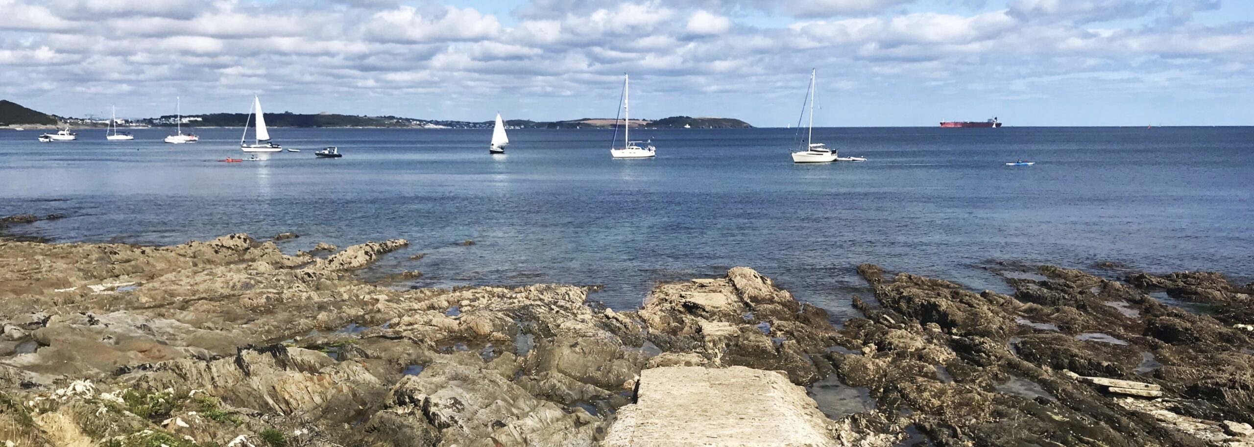
The last day of the hike from Mousehole to Falmouth starts with a river crossing and then you’re almost home and dry! The approach to Falmouth is gorgeous: the bluest of blue waters, dotted with fishing boats in the harbour.

Falmouth’s harbour is one of the largest natural harbours in the world which does mean it has space for cruise ships, looking incongruously large in among the fishing boats. This means Falmouth is one of the busier towns in Cornwall, and is more visited by foreign tourists than most other similar-sized towns in Cornwall.
Shortening the hike
It’s a little bit difficult to shorten the hike from Mousehole to Falmouth due to how remote this section is. This means there is not a lot of public transport between Penzance and Falmouth.
However, you could divide it into two stretches: Mousehole to Lizard, and Lizard to Falmouth. These sections are three days each.
Before or after Mousehole to Falmouth
I have hiked the eight-day stretch from Tintagel to St Ives which I highly recommend due to its breathtaking scenery.
I have not yet done the four-day stretch around the very western tip of Cornwall, reportedly one of the hardest sections of the South West Coast Path, but I have been to many places along that way and I can confirm that the scenery there is absolutely stunning.
A more accessible stretch is the three days from Falmouth to Par. This section takes you through a mixture of delightful fishing villages, remote clifftops and dense woodland.
As well as this, I hope to do many more sections of the South West Coast Path!