The route from Falmouth to Par takes you along the stunning Roseland Peninsula. You’ll pass through a mixture of busy towns and sleepy villages. Long swathes of this section go through woodland or along narrow footpaths but there are also some lovely sections along clifftops, where the vast, flat sea glitters as far as you can see.
I don’t intend to repeat the extremely helpful information you can find on the South West Coast Path website. This is an account of my own experience with tips I would have found useful to know before embarking on the hike from Falmouth to Par.
Getting there
I travelled from London and back by train. To get to Falmouth, I took the train to Exeter, then one to Truro then a third train to Falmouth. On the way back, I took a direct train from Par to London Paddington.
Falmouth
Falmouth has one of the world’s largest natural harbours. Although it’s one of Cornwall’s major towns, it still has the county’s trademark cobbled streets, colourful bunting and fish-and-chip shops, along with the tangle of white masts from the fishing boats in the harbour.

Like many of Britain’s seaside towns, Falmouth is an artsy place. It has a well-known art college and lots of galleries where artists display and sell their work.
I was initially surprised to hear American accents whilst walking around Falmouth. However, I quickly realised that this is because Falmouth is on the cruise ship map. This means you’ll find more international tourists in Falmouth than in other parts of Cornwall. It does also mean that Falmouth is quieter in the evenings than during the day. So if you can spend a night in Falmouth before embarking on your hike then I would recommend it.
Day 1: Falmouth to Portloe (14 miles)
On the first day, you’ll hike 14 miles from Falmouth to Portloe.
Your first task for the day is to catch the ferry from Falmouth to St Mawes. These ferries depart from two piers in Falmouth: the Prince of Wales Pier and Custom House Quay. They’re fairly regular, usually on the half-hour, or on the hour on Sundays. The journey takes about 20 minutes and costs £10 for one way as of August 2025 (or £15 for a return, which you won’t need for this hike!) but you can get a 10% discount if you buy your ticket online in advance.

You’ll dock at the whitewashed village of St Mawes … and then you’ll catch a second ferry across the bay to Place. The St Mawes to Place ferry is just a small open boat and the crossing takes about 10 minutes. It only operates between Good Friday and October – so take note if you’re doing this hike in the winter! The ferry from St Mawes to Place costs £6.30 one way as of August 2025.
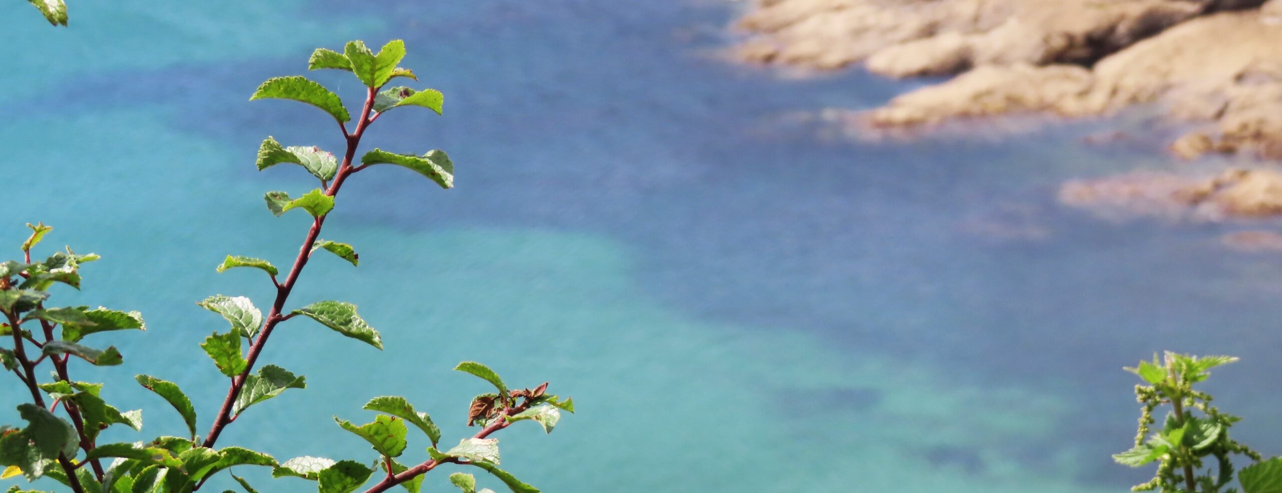
Once you’re at Place, head right and make for St Anthony’s Church, located atmospherically in the woods. Then you’ll soon come out onto the cliffs where you can fully appreciate the beauty of the Roseland Peninsula. This stretch mainly comprises rocky cliffs with the occasional arc of sandy beach. The seawater is clear – you can easily see the rocks underwater, turning the sea a darker shade of turquoise. You can see St Mawes across the sea which makes you feel like you’re on an island!
The first village you’ll reach is Portscatho, which seems to appear out of nowhere. I’d recommend stopping here for lunch. It’s a typical small Cornish village with tiny harbour, lots of art galleries and flowers blooming from the gardens of whitewashed houses.
The rest of the day’s walk is more remote. I hardly saw a soul other than the occasional dog walker near the beaches.

One strange landmark along the way is Mallets Cottage, right at the top of a cliff. This is an eerie tumble-down house at the top of the cliff, weathered by years of fierce winds and salty sea spray. Although it is rather creepy, it has wonderfully dramatic views of the sea thrashing against the sharp, black rocks below.
The last part of the path between Falmouth and Portloe is the most tiresome (yes, I mean tiresome not tiring). Around Broom Parc there is a section which is very narrow and overgrown. It was a rainy day when I did this hike so it was damp work forcing my way through the dripping ferns hanging over the path. Later on, to my relief, the foliage had been ruthlessly hacked back – maybe they’re working their way up the path!
Portloe suddenly becomes visible on the next headland, tucked into an inlet between high, dark cliffs. Aside from the gothic backdrop, Portloe is another characteristically Cornish village, with fishing boats pulled up the harbour slipway and white, flat-fronted houses lining the harbourfront.

Day 2: Portloe to Mevagissey (12 miles)
I stayed overnight in Veryan which is slightly inland from Portloe. Accommodation is the main logistical difficulty of hiking the South West Coast Path. Most of the places you pass through are small and have limited accommodation options, so you sometimes have to look further afield for somewhere to stay.
I left Veryan as the church bell tolled nine, accompanied by the faint smell of bacon frying for people’s Sunday morning breakfast, and returned to Portloe down steep, narrow country lanes. The path between Portloe and Portholland was overgrown again, and I beat valiantly through the brushing ferns, the scratching brambles and the stinging nettles. Not the most pleasant part of the hike!
After Portholland, the path thankfully opens up into fields atop cliffs. It’s difficult to describe the sense of freedom I feel in places like this. You can hear the waves splashing against rocks below. A field of grass-heads waves like a silk parachute in the breeze, sloping down to the crinkled blue sea. Crickets buzz in the grass, the jutting cliffs zigzag ahead and I am breathless with the openness of it all.

In the afternoon, you’ll pass Hemmick Beach, its flat waves contrasting with the castle turrets from Caerhays Castle, and then Dodman Point with its huge stone cross acting as a navigation aid to ships. Further round the headland, after a short spell of sea-drizzle had cleared, I was able to see the Lizard on one side and the peninsula at Salcombe (Devon) on the other.
Once you pass through Gorran Haven, you’re on the home strait. Gorran Haven is a larger village with cafés, fish and chip shops, and a lively harbour and beach. Cross the fields and you’ll reach Portmellon which blends seamlessly into Mevagissey.
Mevagissey is renowned as a beauty spot. Its distinctive double walled harbour is full of fishing boats, and its white lighthouse stands stoically on the outer wall. Some of Mevagissey’s stone houses are whitewashed and others are painted in soft oranges or lemon-yellows. Flags flap at the tops of the creaking flagpoles lining the harbour. It has a wholly-justified reputation as one of Cornwall’s prettiest villages.

Day 3: Mevagissey to Par (12 miles)
The next morning, after a steep climb out of Mevagissey, you’re rewarded with the view back to the village, the lighthouse now looking tiny against the towering cliffs. The path continues to climb and descend sharply for most of the morning, through a mixture of woodland and open fields.
I suggest either bringing lunch with you from Mevagissey and finding a picnic spot, or stopping for lunch in Charlestown. The number of people visiting Charlestown was somewhat jarring after a morning hiking through quiet villages I discovered that it’s on the tourist map for two reasons: first, it’s a film location and secondly its harbour is a UNESCO World Heritage Site.

Just a bit further along the path is Carlyon Bay, which is a wide stretch of pale sand with plenty of amenities if you want to stop for a snack. After that, cross the golf course and walk the last stretch of the hike beside rockpools with some of the clearest seawater on the whole way from Falmouth to Par. And then you’ll arrive in Par!
Par is less nice than all of the villages you pass through when hiking from Falmouth to Par. It’s more industrial, with a large power station, and is more car-oriented than other villages. As an ending to a three-day hike, it’s a little bit underwhelming. On the plus side, it is a very convenient place to end the hike as you can catch a direct train back to London.
Before or after Falmouth to Par
I have hiked the stretch of the South West Coast Path immediately before this one: a six-day hike from Mousehole to Falmouth around the Lizard Peninsula.
The next section after Par is a three-day hike from Par to Plymouth. Both towns have direct train connections to London so I’ve got my eye on that section as a long-weekend hike!
The South West Coast Path is a gift that keeps on giving. I hope to do many more sections of it with the aim of completing the whole thing one day!